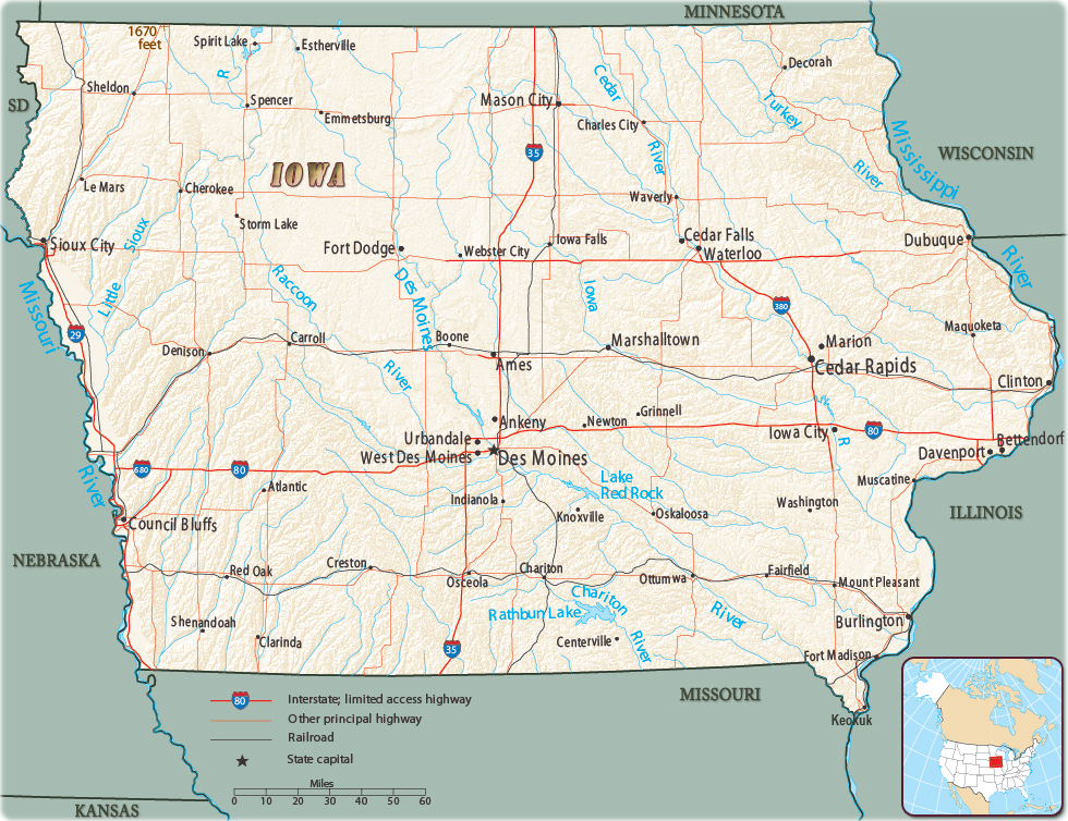
Map of IOWA
The state of Iowa is located between the Missouri and Mississippi rivers. It is bordered by Wisconsin to the northeast, Illinois to the east, Missouri to the south, Nebraska to the west, South Dakota to the northwest and Minnesota to the north. The state capital and largest city is Des Moines.

|
Copyright © Geographic Guide - Maps World. United States of America. |
Iowa State Capitol, in Des Moines, constructed between 1871 and 1886, with five domes.
Source (edited): U.S. Geological Survey.