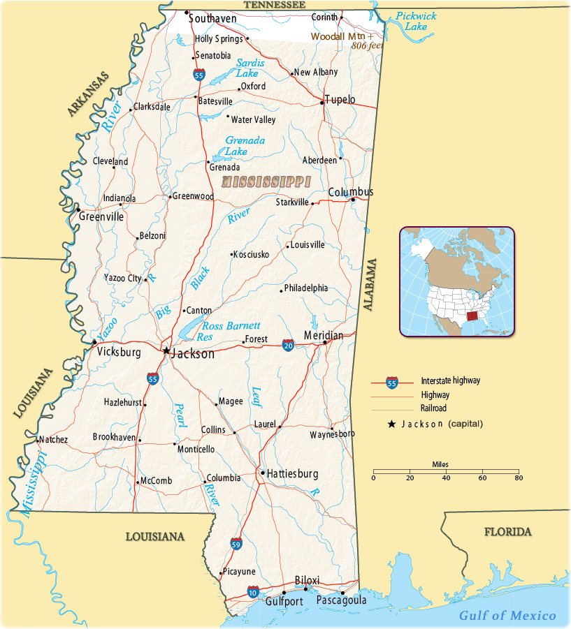
Map of the State of Mississippi
The State of Mississippi, in the Southeastern United States, bordering on the Gulf of Mexico, was early explored by the Spanish and colonized by the French. It is bordered to north by Tennessee, to the east by Alabama, to the south by the Gulf of Mexico, to the southwest by Louisiana, and to the northwest by Arkansas. Jackson is the state capital and largest city


Monuments at the National Military Park in Vicksburg. The place was the stage of a siege and represented a vital victory to the Union during the Civil War.
|
Copyright © Geographic Guide - Maps World. United States of America. |
Source (edited): U.S. Geological Survey.
