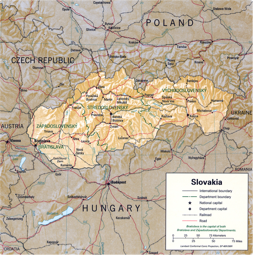
Slovakia Map
Slovakia is a country in central Europe, bounded on the northwest by the Czech Republic, on the north by Poland, on the east by Ukraine, on the south by Hungary, and on the southwest by Austria. Bratislava is its capital and largest city.
The Danube River, located in the southwest, forms part of Slovakia’s border with Hungary.
Slovakia existed as part of Hungary from the beginning of the 10th century until 1918, when it united with the Czech lands of Bohemia and Moravia, in addition to a small part of Silesia, to form Czechoslovakia. In 1939, Slovakia declared its independence under pressure from Germany, but in 1945 it was reunited with the rest of Czechoslovakia. From 1948 until 1989 Czechoslovakia was ruled by a Soviet-style Communist regime. In 1993 the country broke apart, and Slovakia and the Czech Republic became independent.
Source: U.S. Central Intelligence Agency - 1994. Note: since 2002, Slovakia is divided into 8 self-governing regions (samosprávne kraje).
|
Copyright © Geographic Guide - Maps World, European Continent. |

Slovakia Map