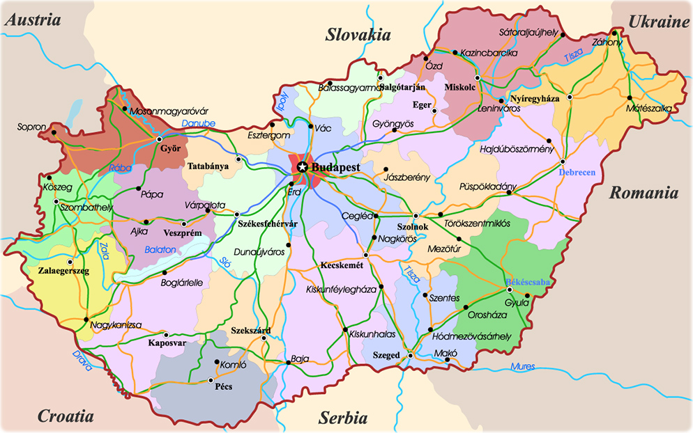
Hungary is an European country, predominantly flat. The Danube
River forms part of Hungary’s northwestern border with Slovakia, and then flows
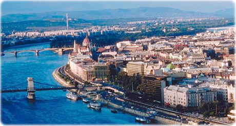
south through Budapest,
the capital, dividing Hungary into two general regions. A low, rolling plain
called the Great Alföld, covers most of the region east of the Danube extending
east to Romania and south to Serbia. Highlands
along the northern border of the country extend eastward from the gorge of the
Danube at Esztergom and include the Mátra mountains, a part of the Carpathian
Mountain system. Mount Kékes (1,014 m), in the Mátra Mountains, is the highest
peak in Hungary. The area west of the Danube presents a
variety of land forms. In the south rise the isolated Mecsek Mountains. In the
north are the Bakony Mountains
which overlook Lake Balaton. The Little Alföld, or Little Plain, in the extreme
northwestern section of Hungary, extends into southern Slovakia. The Danube is
Hungary’s most important river. Other major rivers, all tributaries of the
Danube, include the Tisza, the longest river in Hungary, and the Raab and Drava
rivers. Lake Balaton is the largest lake in central
Europe.
Hungary is an European country, predominantly flat. The Danube
River forms part of Hungary’s northwestern border with Slovakia, and then flows
south through Budapest,
the capital, dividing Hungary into two general regions. A low, rolling plain
called the Great Alföld, covers most of the region east of the Danube extending
east to Romania and south to Serbia. Highlands
along the northern border of the country extend eastward from the gorge of the
Danube at Esztergom and include the Mátra mountains, a part of the Carpathian
Mountain system. Mount Kékes (1,014 m), in the Mátra Mountains, is the highest
peak in Hungary. The area west of the Danube presents a
variety of land forms. In the south rise the isolated Mecsek Mountains. In the
north are the Bakony Mountains
which overlook Lake Balaton. The Little Alföld, or Little Plain, in the extreme
northwestern section of Hungary, extends into southern Slovakia. The Danube is
Hungary’s most important river. Other major rivers, all tributaries of the
Danube, include the Tisza, the longest river in Hungary, and the Raab and Drava
rivers. Lake Balaton is the largest lake in central
Europe.