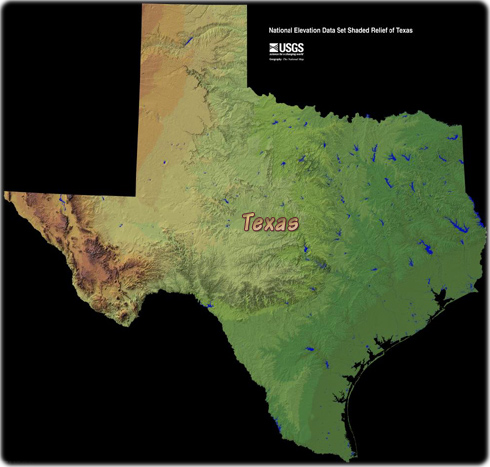
Map of Texas - Multimodal

Texas is one of the West South Central states of the U. S. It borders Mexico on the southwest and the Gulf of Mexico on the southeast. To the west is New Mexico, to the north and northeast lie Oklahoma and Arkansas, and Louisiana bounds Texas on the east. The capital is Austin and Houston is the largest city.


Dallas Skyline (photo Dibrova).

A black tarantula, a native species from Texas. There are about 14 species of tarantulas in Texas.
|
Copyright © Geographic Guide - Maps World. United States of America. |
Political map
Source (edited): U.S. Geological Survey.
