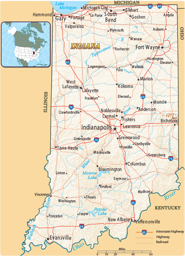
Map of Indiana
Indiana became the 19th U.S. state on December 11, 1816. Indiana borders the state of Michigan to the north, Ohio to the east, Kentucky to the south and southeast, and Illinois to the west. Lake Michigan is to the northwest.
One of the covered bridges in Indiana, the historic 4th Roann, built in 1877 by the Smith Bridge Company. It crosses the Eel River.


|
Copyright © Geographic Guide - Maps World. United States of America. |
Source (edited): U.S. Geological Survey.