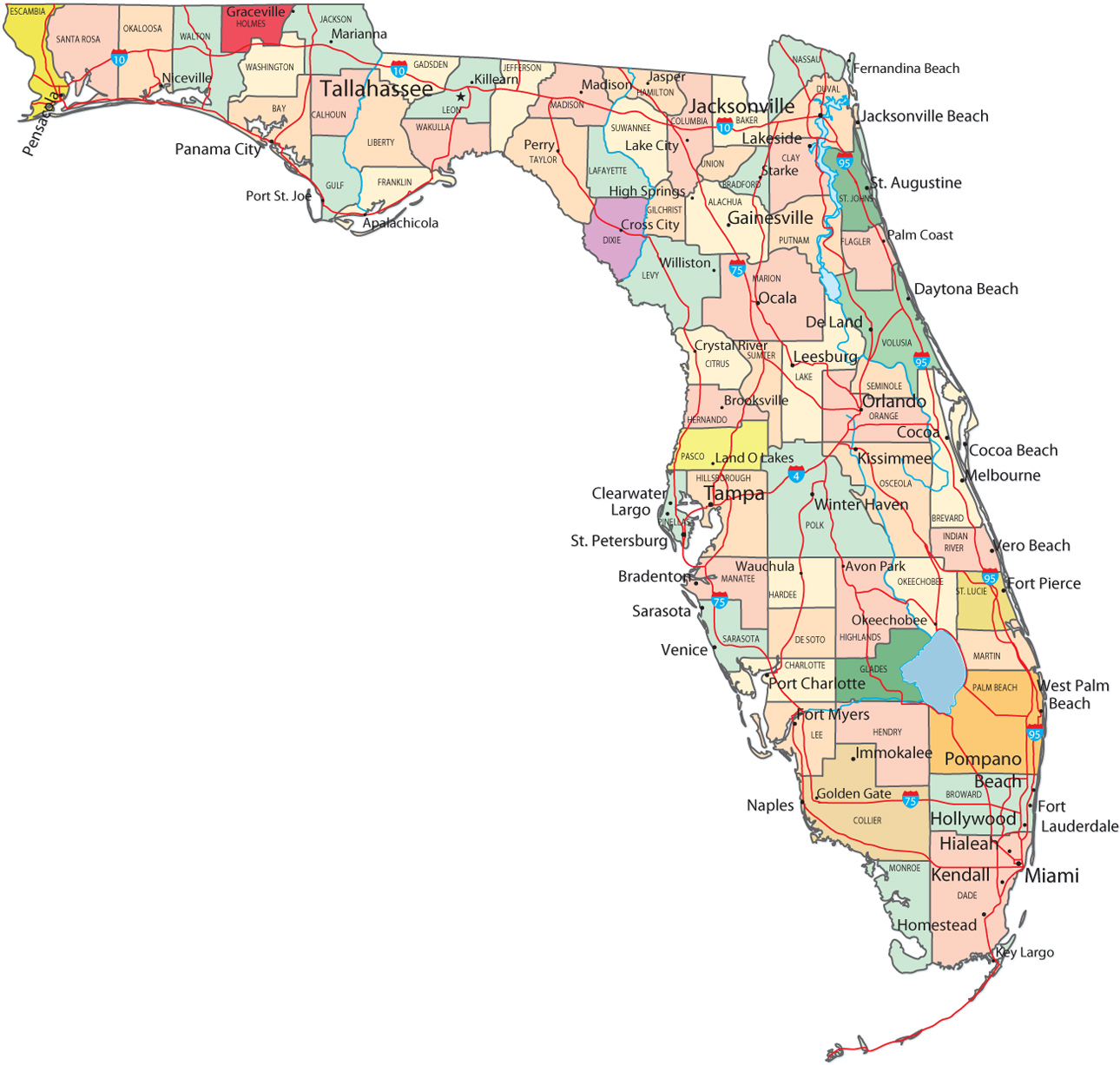
Political Map of Florida

Florida Keys (USA. November 1990). The Florida Keys, a line of narrow, low islands that begins at Key Largo extend in a gently curving, southwesterly arc along U. S. Highway 1 to Key West. Visible in this photograph are keys from Big Pine Key (near bottom center) to Sugarloaf Key (top center). Atlantic Ocean and Gulf of Mexico tides cut numerous channels through the coral and granular limestone sand (oolite) to create the islands (keys), which have thick growths of mangrove (darker areas) and many bays. The sediment plumes appear to be moving northwesterly into the Gulf of Mexico from the southeast (Atlantic Ocean). Because of the clarity of water throughout the region, water depth can be determined by different shades of blue—deeper water is darker and shallow water is lighter. In many instances these colors can represent differences in depth of tens to hundreds of feet (NASA).


Tourists at the KSC Visitors Complex one of the top tourist attractions in Florida. It is located within the Merritt Island National Wildlife Refuge.
Sunset on Everglades, Paurotis Pond.

Map of Florida - Multimodal
|
Copyright © Geographic Guide - Maps World. United States of America. |
|


Source (edited): U.S. Geological Survey.
