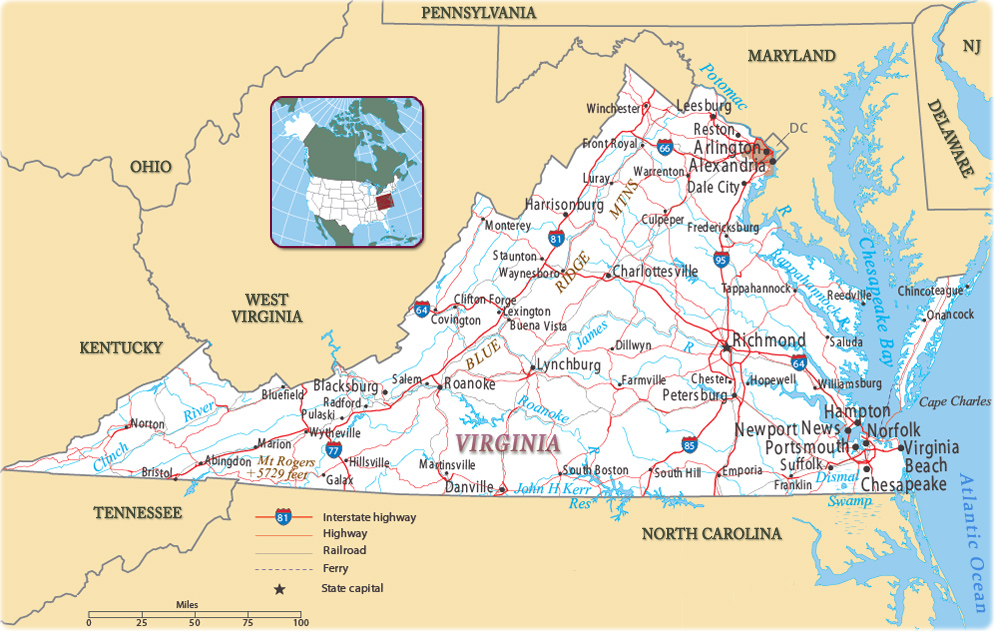
Map of Virginia
The Commonwealth of Virginia is state in the eastern U.S.A. and one of the original 13 colonies. It was named after Elizabeth I of England, the Virgin Queen. The capital is Richmond. Virginia is bounded on the east by the Atlantic Ocean, on the north and east by Maryland and the District of Columbia, on the west by the state of West Virginia and Kentucky, and on the south by Tennessee and North Carolina.


Wren Building, College of William and Mary, in Williamsburg, Virginia. Williamsburg was founded in 1632 and was the capital of the Colony of Virginia, from 1699 to 1780.
|
Copyright © Geographic Guide - Maps World. United States of America. |
Source (edited): U.S. Geological Survey.
