Luxembourg
Luxembourg is a small country in western Europe, bordering France, Germany, and Belgium. The nation’s capital and largest city is called Luxembourg City.
Luxembourg measures only about 89 km from north to south and 56 km from east to west. The northern region, known as the Oesling, or E’sleck, consists of the rugged uplands of the Ardennes plateau. In the south is the Bon Pays, a fertile area of low, gently rolling, hills.
Much of Luxembourg is crisscrossed by the broad, deep valleys of swift streams and rivers. The principal river is the Sauer, a tributary of the Mosel. The Sauer cuts across northern Luxembourg through winding, wooded valleys and past historic towns such as Esch-sur-Sûre.
Although famous for its picturesque villages, medieval castles, and natural beauty, Luxembourg is a prosperous urban and industrialized nation. Until the 1970s, iron and steel industries dominated Luxembourg’s economy, but depleted iron-ore reserves and declining international demand prompted considerable economic diversification. Other important heavy industries, many of which are financed by foreign investment, include the production of tires, glass, and chemicals. In recent decades the growth of financial services has established Luxembourg as a tax haven and major banking center.
Despite its declaration of neutrality after 1867, Luxembourg was occupied by Germany during both WWI and WWII. After World War II, Luxembourg abandoned its neutrality in support of greater international cooperation.
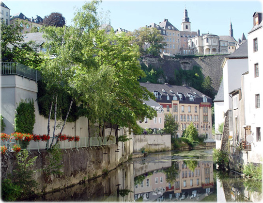
A canal in the city of Luxembourg.

Political Map of Luxembourg
|
Copyright © Geographic Guide - Maps World, European Continent. |
Bart Goossens