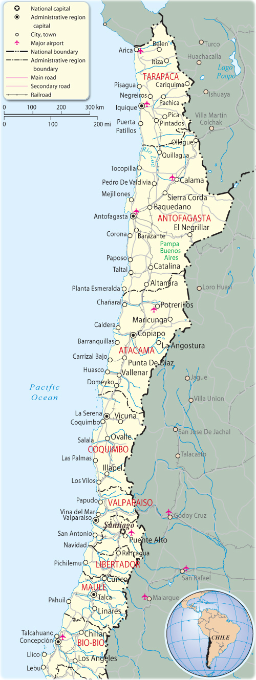
Map of North Chile
The northern region of Chile is divided into the Norte Grande (Far North) and the Norte Chico, two of five natural regions of continental Chile, as defined by the government agency CORFO in 1950.
The Norte Grande, which extends from the Peruvian border to about 27° south latitude, a line roughly paralleled by the Copiapó river, is extremely arid. It contains the Atacama Desert, one of the driest areas in the world; in certain sections, this desert does not register any rainfall at all. Average monthly temperatures range at sea level between about 20.5 °C during the summer and about 14 °C during the winter. Most of the population lives in the coastal area, where the temperatures are more moderate and the humidity higher.
The Norte Chico region is bordered to the north by the Norte Grande region. To the west lies the Pacific Ocean, to the east the Andes mountains and Argentina, and to the south the Zona Central natural region. This region is also subject to droughts, but the winter rains and snowmelt from the Andes Mountains provide water to rivers in the Norte Chico region, even though the river flow varies with the seasons. The slopes of the Andes are precipitous, the general surface is rough, and in the north the higher ground and coast are still barren.
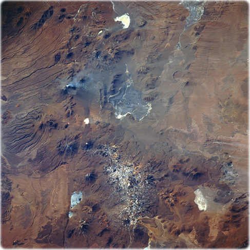
Lascar Volcano (NASA, July 1995). With the exception of the road (light-colored, linear feature) along the eastern edge of the great salt flat, Salar De Atacama (left middle), little evidence of human presence can be observed in this remote and arid region of northern Chile. Characterized by dramatic elevation changes, numerous volcanic features and a variety of eolian and fluvial landforms can be identified in this arid environment.
The western side (left) of the image is roughly 2286 m above sea level. Just 40 km to the east, the average elevation of the Andes Mountains increases to about 5486 m. Several stratovolcanoes, including Lascar Volcano, may be recognized by a pronounced radial drainage (erosional) pattern on the flanks of the volcanoes. Lascar Volcano, located by the V-shaped ash plume that extends eastward from the April 1993 eruption, is barely discernible. Several highly reflective (whitish) salars (salt flats) are scattered throughout the high altitude terrain. The boundaries of two large salars (Salar De Aquas Calientes-center of image- and Salar De Quisquiro-near upper right corner) can be mapped. The darker, somewhat paralleling lines, aligned east-west along the western slopes of the Andes Mountains (left edge), are fluvial landforms; while, the less distinct features (paralleling lines in the upper right corner) are the result of eolian processes.
|
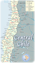
Copyright © Geographic Guide - Maps World, American Continent. |
Map of North Chile