Maps of Chile
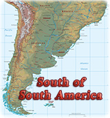
Chile is a country in southwestern South America, occupying a long, narrow ribbon of land along the Pacific Ocean. Chile stretches approximately 4,270 km from north to south but its average width is less than 180 km. Its landscapes range from arid desert in the north to windswept glaciers and fjords in the south. A fertile valley covers the center of the country. The snowcapped peaks of the Andes Mountains run along the border with Argentina to the east. Santiago, Chile’s capital and largest city, is located in the Central Valley.
The majority of the people live in the middle of Chile, in towns and cities in the fertile lowland of the Central Valley. Most of the people are of mixed Spanish and Native American ancestry. Chile is one of the leading industrialized nations of South America. It has a strong economy based on mining, especially copper mining, and agricultural goods, largely for export.
Chile was a colony of Spain from the 16th century until it achieved independence in the early 19th century. Roman Catholicism is the dominant religion and Spanish is the official language.
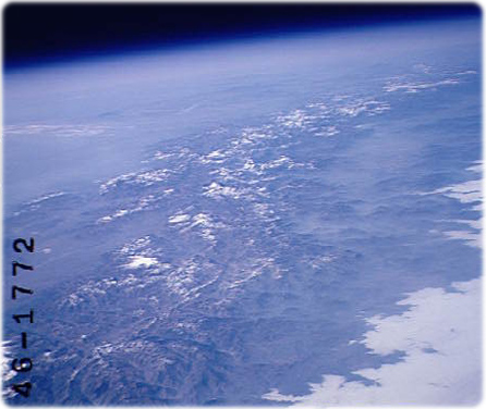
Southern Andes Mountains, Chile and Argentina (Winter/Spring 1997). Volcanic peaks, snowcapped ridges and glacial lakes of the southern Andes Mountains are visible in this image. Between the mountains and the Pacific Ocean (lower right), the fertile Central Valley of Chile appears greener.
Andes Mountains, border of Chile and Argentina, as seen from space.


|
Copyright © Geographic Guide - Maps World, American Continent. |
