|
Copyright © Geographic Guide - Maps World, American Continent. |
Map of South America- Interactive
|
Copyright © Geographic Guide - Maps World, American Continent. |
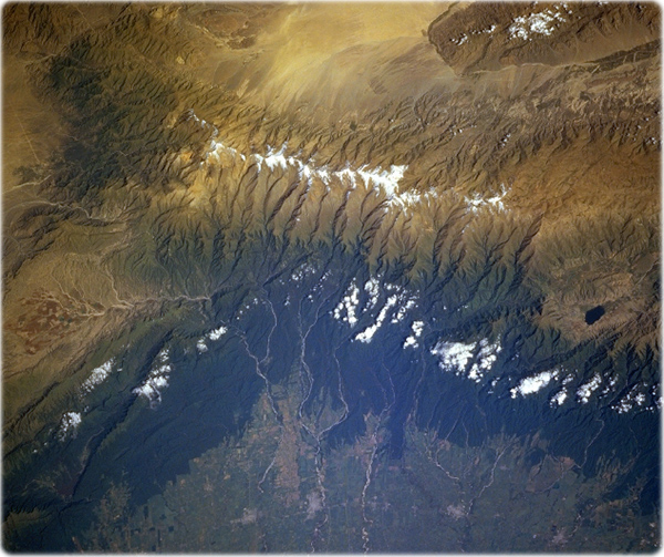
Aconquija and Cajon Ranges (NASA, Argentina Winter/Spring 1997). The forested Aconquija Range, part of the Andes chain, includes many peaks exceeding 4880 m. The high plains to the east (bottom of image) are semi-arid agricultural lands producing mostly grains, cotton, and flax. Several small cities are discernible along the foothills of the Aconquija; from north to south (right to left) they are Monteros, Concepción, Aguilares, and Villa Alberdi. Numerous streams, tributaries of the Dulce River, descend from the mountains into the plains past the cities. The southern Cajon Range is at upper right, and the yellowish Arenal flats are at upper center.

A paradise called Itacaré, in southern Bahia, Brazil.
Maps of Continents
