
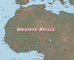
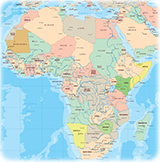
Political Map of Western Africa
The Western Africa is a geographic region comprising the countries of Benin, Burkina Faso, Cameroon, Cabo Verde, Chad, Côte d’Ivoire, Equatorial Guinea, The Gambia, Ghana, Guinea, Guinea-Bissau, Liberia, Mali, Mauritania, Niger, Nigeria, Senegal, Sierra Leone and Togo. The region has a rich biodiversity and several distinct regions.
The northern portion of western Africa is composed of a semiarid terrain, stretching from the Atlantic Ocean on the west to the area of Lake Chad on the east. It is largely a plateau of modest elevation and borders the Sahara on the north and the coast forests on the south.
Early history in western Africa includes a number of prominent regional powers that dominated different parts of both the coastal and the trans-Saharan trade route, such as the Mali and Gao Empires.
|
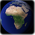
Copyright © Geographic Guide - Maps World. African Continent. |
◄ Africa