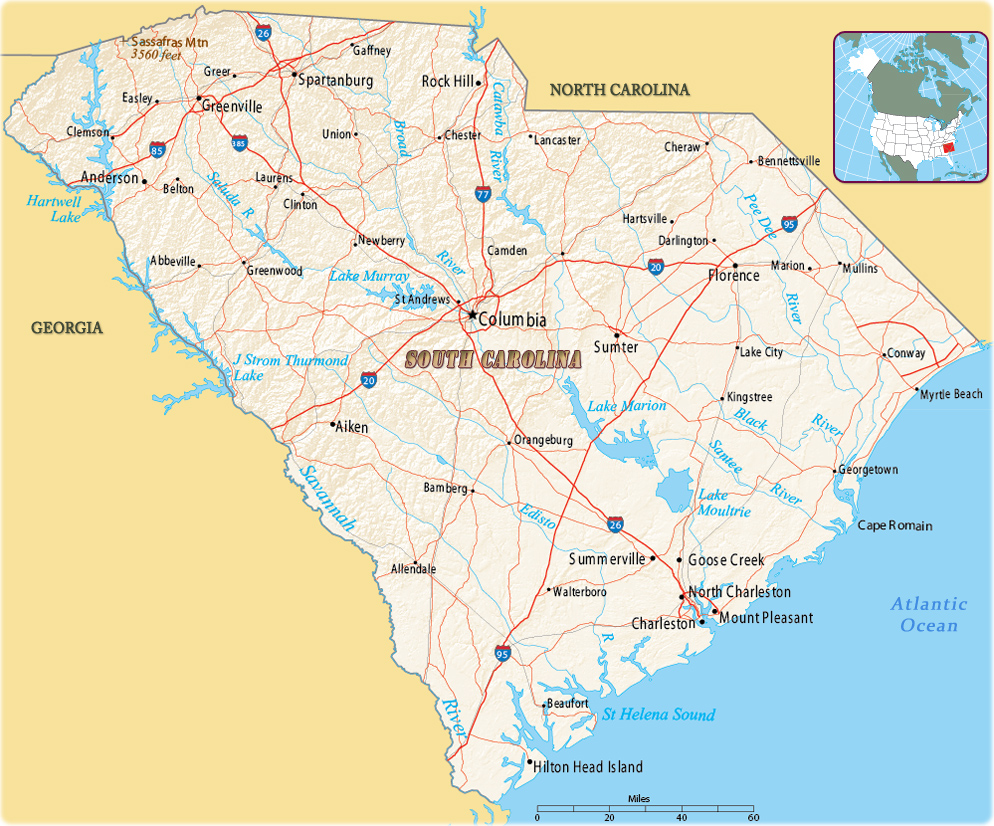
Map of South Carolina
Source (edited): U.S. Geological Survey
South Carolina is a state in the southeastern United States of America, on the Atlantic coast. To the north lies the state of North Carolina and to the southwest lies the state of Georgia. It was settled in 1733 by James Oglethorpe and was the 13th British colony formed. The capital and largest city is Columbia.


The Poinsett Bridge, the oldest bridge in South Carolina, built in 1820 as part of a road from Columbia to Saluda Mountain. It was named after the physician and diplomat Joel Roberts Poinsett.
|
Copyright © Geographic Guide - Maps World. United States of America. |
