Political Map of Albania

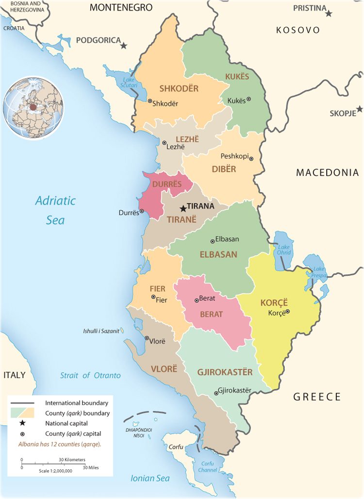
The Republic of Albania (Republika e Shqiperise) is a country in southeastern Europe, in a strategic location along Strait of Otranto, bordering the Adriatic Sea and Ionian Sea, between Greece in the south and Montenegro and Kosovo to the north. Its terrain is mostly mountains and hills, with small plains along coast. The highest point is Maja e Korabit 2,764 m. Counties: Berat, Diber, Durres, Elbasan, Fier, Gjirokaster, Korce, Kukes, Lezhe, Shkoder, Tirane, Vlore. Major seaports are Durres, Sarande, Shengjin and Vlore. Exports (commodities): textiles and footwear; asphalt, metals and metallic ores, crude oil; vegetables, fruits and tobacco. Border with North Macedonia.

Source: U.S. CIA - 2008. Administrative Divisions.
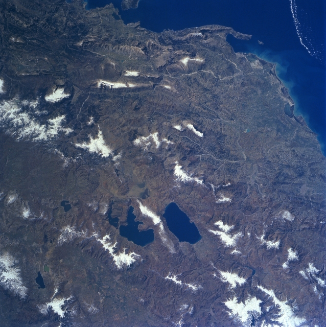
Lakes Ohrid and Prespa, Albania/North Macedonia (NASA, Winter/Spring 1997) Located just below the center of the image, Lake Ohrid, the deepest lake in the Balkans, can be seen in this south-southeast looking view. Just to the left of Lake Ohrid is Lake Prespa, the highest lake in the Balkans. The smaller Mikri Prespa is just to the left (east) of Lake Prespa. Lake Ohrid is 40 km long and covers and area of 340 km². Lake Prespa is 23 km long and approximately 13 km wide and covers an area of 290 km². Lake Prespa drains into Lake Ohrid through a series of underground channels. The terrain around the lakes is hilly but not overly steep. The region around the lakes supports a larger population than other inland areas in Albania, northern Greece, and Macedonia. Most of Albania is visible in this view (right of the lakes). The terrain, except for a narrow coastal plain, is mountainous and often inaccessible. Soils are of a poor quality except in the intermontaine river valleys, along Lakes Orhid and Prespa. The Vlores Gulf and Adriatic Sea are visible in the top right corner of the image.
|
Copyright © Geographic Guide - Maps World, Balkan Peninsula. |
