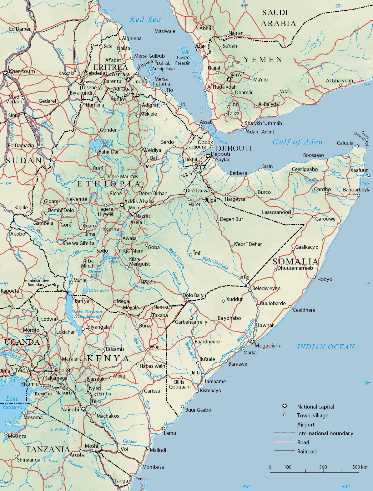
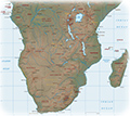
Physical Map of the Horn of Africa
Horn of Africa is a region of eastern Africa, the easternmost extension of African continent into the Indian Ocean. It usually includes the countries of Djibouti, Eritrea, Ethiopia, and Somalia, whose cultures have been linked throughout their history.
Geographically the protruding shape that resembles a "Horn" consists of the "Somali peninsula" and eastern part of Ethiopia. The region is of strategic importance as it is bathed by the Red Sea and the Gulf of Aden, where large oil tankers pass.
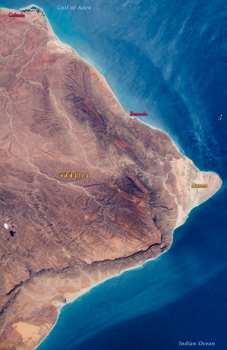
The tip of the Horn of Africa, image taken by the ISS, on June 4, 2018. The coastline is rugged, with mountains, dry river beds and steep cliffs that cast shadows on the landscape.
|
Copyright © Geographic Guide - Maps World, African Continent. |
Physical Map of the Horn of Africa